The distance from Moab to Capitol Reef National Park is approximately 140 miles by car. The driving time would depend on the route taken and the speed at which you travel, but it would likely take about 3 hours or more to drive from Moab to Capitol Reef National Park.
Moab to Capitol Reef: directions
⚠️ Check the road conditions and UDOT – Utah’s traffic authority – before your trip.
Traveling westbound on Interstate 70: Follow I-70 west to exit 149, take Utah State Route 24 (SR-24) west toward Hanksville (exit 149) and continue for 43.8 miles (70.5 km) Turn right to continue on SR-24 west and continue for 37.3 miles (60 km).
Traveling eastbound on Interstate 70: Follow I-70 east to exit 40, turn right onto Utah State Route 120 south/ North Main Street and continue for 1.2 miles. Turn left onto Utah State Route 118 north/ E 300 N and continue for 0.8 miles. Make a slight right onto Utah State Route 119 east and continue for 8.8 miles.
Turn right onto Utah State Route 24 east and continue for 63.4 mile.
Traveling northbound on Interstate 15: Follow I-15 north to exit 95. Take Utah State Route 20 toward US-89/ Panguitch/ Circleville (exit 95) and continue for 20.4 miles. Turn left onto US-89 north and continue for 21.3 miles. Turn right onto Utah State Route 62 and continue for 12.4 miles. Turn left onto Utah State Route 62 north and continue for 30.6 miles. Turn right onto Utah State Route 24 east and continue for 47.1 miles.
Traveling southbound on Interstate 15: Follow I-15 south to exit 188. Take US-50 east toward Scipio (exit 188) and turn left onto Utah State Route 50 and continue for 0.7 miles. Turn right onto US-50 east/ North State Street and continue for 24.4 miles. Turn right onto Utah State Route 260 south and continue for 4.2 miles. Turn right onto Utah State Route 24 (SR-24) east and continue for 2.8 miles. Make a slight left to stay on SR-24 east and continue for 71.3 miles.
Utah State Route 12: This 123 miles highway connects US-89, just south of Panguitch and Torrey (intersection with Utah State Route 24). It crosses Dixie National Forest, goes by Bryce Canyon National Park, and cuts through much of Grand Staircase-Escalante National Monument before reaching the town of Torrey. The drive to or from Bryce Canyon to Capitol Reef takes about three hours on SR-12.
For Utah State Route 12: Travelers should be aware that some GPS devices or cell phones may suggest taking the South Draw Road from Lower Bowns Campground and Reservoir. However, it is important to note that this road is an unmaintained, high-clearance 4WD road and is not suitable for passenger cars, RVs, or drivers who are inexperienced with off-road driving. It is not recommended to take South Draw Road.
About Capitol Reef

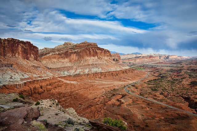
Capitol Reef is a United States National Park located in south-central Utah. The park is approximately 60 miles long on its north–south axis, with a maximum width of 6 miles. It is located in Wayne and Garfield counties, and is surrounded by the Fishlake National Forest, the Dixie National Forest, and the Grand Staircase-Escalante National Monument.
Capitol Reef is known for its colorful landscape, natural arches and bridges, and the Fremont culture petroglyphs and granaries found in the area. The park’s centerpiece is the Waterpocket Fold, a 100-mile monocline, or wrinkle in the Earth’s crust.
